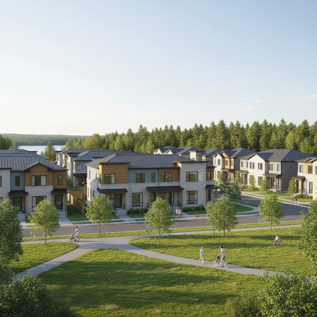
Approximately 4,900 homes on 545 acres — from single-family houses to
apartment buildings in Halifax’s newest planned community.
A New Community Takes Shape
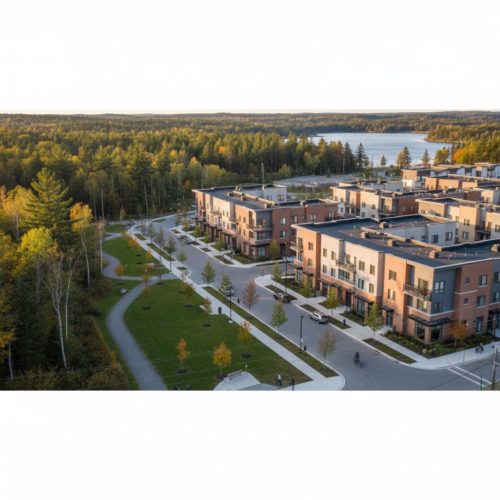
Port Wallace represents one of the largest residential developments in Halifax Regional Municipality’s history. Spanning approximately 545 acres between Lake MicMac and Lake Charles, the community is planned for roughly 4,900 residential units that will eventually house an estimated 9,000 to 10,000 people. The project — marketed by Clayton Developments as “The Parks of Lake Charles” — aims to deliver a diverse, walkable community with a deliberate mix of housing types and densities.
For the full story of how this development came to be, see the Development Timeline.
Housing Mix
The Port Wallace plan calls for a balanced mix of housing types designed to serve a range of household sizes, incomes, and life stages:
- ~35% Low Density — single-family detached homes, semi-detached homes, and townhouses. These will be concentrated in the Port Wallace Low Density Residential zones.
- ~65% Multi-Residential — apartment buildings and condominiums. These higher-density buildings will be located in Port Wallace Higher-Order Residential zones, typically along the central collector road and near commercial areas.
- ~150 Accessible Housing Units — purpose-built accessible units are required as part of the development agreement, ensuring the community is inclusive from the start.
Land Use Zones
The Port Wallace Secondary Planning Strategy establishes four primary land use designations across the development area:
- Port Wallace Low Density Residential — zones for single-family homes, semi-detached, and townhouse developments at lower densities
- Port Wallace Higher-Order Residential — zones permitting apartment buildings, condominiums, and mixed-use structures at higher densities
- Commercial / Institutional — areas designated for retail, services, and community facilities to support the population
- Environmental Open Space — protected natural areas, wetlands, and buffer zones around Lake Charles, Lake MicMac, and connecting waterways
For a visual overview of these zones, visit Maps & Boundaries.
Development Phasing
Port Wallace will be built in phases over many years. Development is planned to start from existing Waverley Road (south of Garden Court) and progress northward toward Avenue du Portage, following the extension of the central collector road and municipal services.
Early phases will connect to existing infrastructure along Waverley Road, while later phases depend on the completion of the North Dartmouth Trunk Sewer and upgrades to Highway 107 (currently at capacity between Montague Road and Akerley Boulevard).
In May 2025, amendments to the development agreement were approved to allow greater phasing flexibility, enabling Clayton Developments to adapt the build-out sequence to infrastructure readiness and market conditions.
“The Parks of Lake Charles”
“The Parks of Lake Charles” is Clayton Developments’ marketing name for the Port Wallace project. Clayton Developments Limited, a division of The Shaw Group with over 160 years of experience, is the lead developer. The project is being advanced through Port Wallace Holdings Limited, a partnership between Clayton and Cresco.
The branding reflects the community’s proximity to Lake Charles and the emphasis on parks and open spaces integrated throughout the development. As planning advances and construction begins, expect to see this name used in marketing materials, signage, and sales activity.
Infrastructure & Development Charges
Port Wallace operates under a “growth pays for growth” funding model. Regional Development Charges (RDCs) were first approved by the Nova Scotia Utility and Review Board (NSUARB) in 2014 and are levied on new development to fund the municipal infrastructure — roads, water, sewer, stormwater — required to service the community.
This means the cost of extending services to Port Wallace is borne primarily by the development itself, rather than by existing Halifax taxpayers. The RDC framework is a key reason Port Wallace was able to proceed as a large-scale greenfield community within HRM’s planning framework.
What Buyers Should Know
Current Status
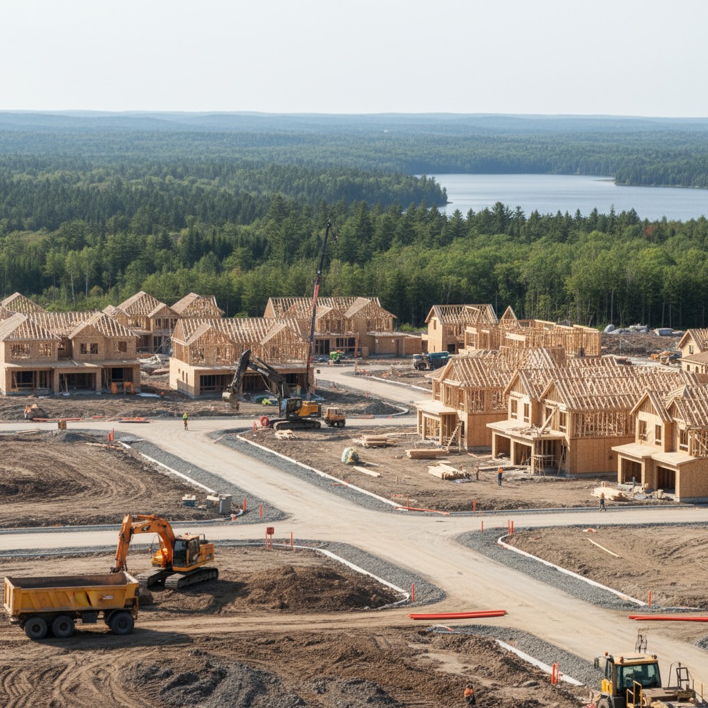
- Port Wallace is in early-stage development. Planning approvals are in place, but construction of homes has not yet begun on a large scale.
- Municipal servicing (water, sewer, roads) must be extended before residential lots can be developed.
- Specific home pricing is not yet publicly available. As of this writing, Clayton Developments has not released pricing for individual lots or units.
- Interested buyers should monitor Clayton Developments and “The Parks of Lake Charles” for sales announcements as the project advances.
Nearby Real Estate Context
Port Wallace is situated near several established residential communities in north Dartmouth, which may be of interest to buyers exploring the broader area:
- Montebello — an established subdivision directly south along Waverley Road, with single-family homes and proximity to Montebello Park
- Keystone Village — a newer development off Waverley Road featuring townhomes and single-family homes
- Portland Hills — a large, mature neighbourhood to the southwest with a full range of housing, commercial services, schools, and transit access
For more on surrounding communities, see Nearby Neighbourhoods.
HRM Planning Resources
The following official resources provide detailed planning information for Port Wallace:
- HRM Port Wallace Planning Page — Halifax Regional Municipality’s official project page with documents, maps, and updates
- Port Wallace Special Planning Area Order (N.S. Reg. 61/2022) — the provincial regulation designating Port Wallace as a Special Planning Area
- HRM Planning Applications — search for active planning applications including PLANAPP 2024-00435